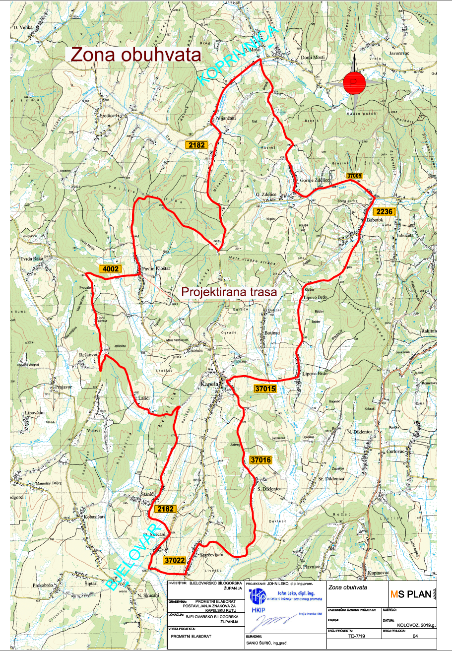
It is 36.8 km long, of which 35.6 km is asphalt and 1.2 km is macadam. The route passes through the villages of Kapela, Babotok, Gornje Zdjelice, Poljančani, Pavlin Kloštar, Stanići and ends in Kapela.
The lowest point is at 127 m, and the highest at 243 m above sea level, which means that the height difference is 116 m.
There are also rest areas on the route consisting of a bench, table, information board, canopy, trash can, and bicycle rack.