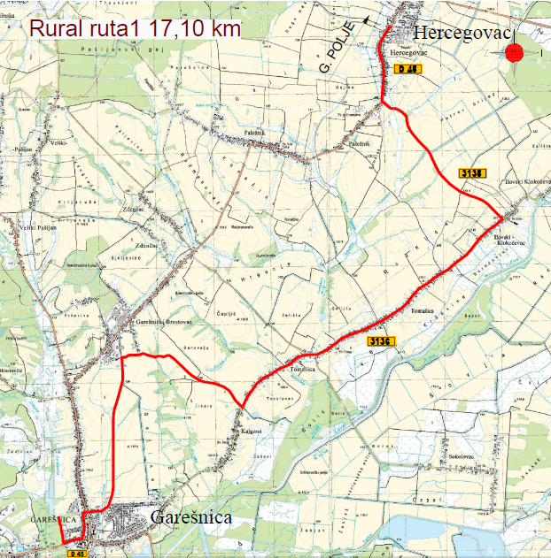
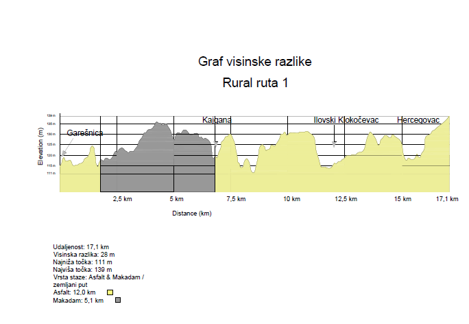
It is located in the area of the city of Garesnica and the municipality of Hercegovac. It is 17.1 km long, of which 12.0 km is asphalt and 5.1 km is macadam. The route passes through the villages of Kajgana, Tomašica and Ilovski Klokočevac with little traffic.
The lowest point is at 111m, and the highest at 139m above sea level, which means that the height difference is 28m.