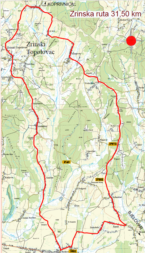
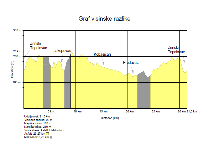
It is located in the municipalities of Zrinski Toplovac, Rovišće and Kapela. It is 31.5 km long, of which 26.27 km is asphalt and 5.23 km is macadam. The route passes through the villages of Zrinski Topolovac, Predavac, Kobasičari, Reškovci and Križ Gornji on lightly trafficked roads.
The lowest point is at 120m, and the highest at 219m above sea level, which means that the elevation difference is 99m.