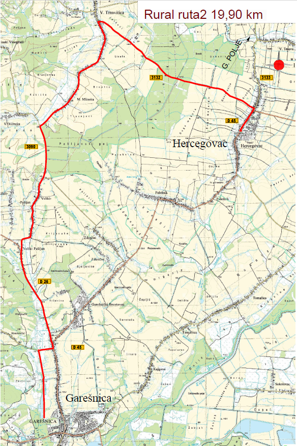
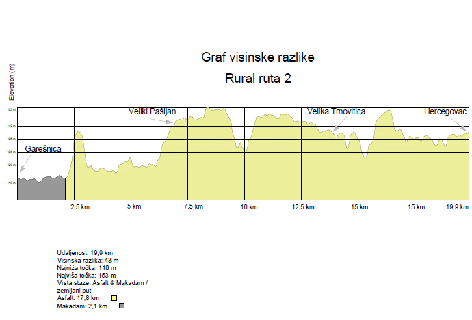
It is located in the area of the town of Garešnica, and the municipalities of Velika Trnovitica and Hercegovac. It is 19.9 km long, of which 17.8 km is asphalt and 2.1 km is macadam. The route passes through lightly trafficked roads.
The lowest point is at 110m, and the highest at 153m above sea level, which means that the height difference is 43m.